


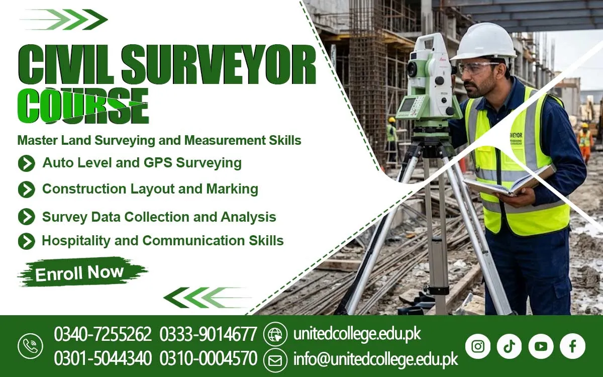

Civil Surveyor Course in Malakand – Develop Professional Surveying Skills
Accurate Land Measurement for Reliable Construction Projects
Imagine a house construction project where the foundation is marked a few inches away from its correct position. This small measurement mistake can create problems during construction and may affect the entire building layout. Similar issues can happen during road development, land division, and commercial construction if measurements are not accurate. This is where civil surveyors play an important role. They help construction teams measure land, check levels, mark boundaries, and understand the exact position of structures before work begins. Surveying provides important information that engineers and construction workers use to complete projects correctly.
For students interested in technical education and construction work, learning these skills can be a useful starting point. The Civil Surveyor Course in Malakand offered by United College of Technology (UCT) introduces learners to the practical knowledge required for land measurement and construction surveying. Students can develop an understanding of surveying methods, measuring equipment, site layouts, and basic fieldwork. These skills are useful in different construction activities, including residential buildings, roads, bridges, and infrastructure development. With proper guidance and practical learning, beginners can gradually understand the responsibilities of a civil surveyor and the importance of accurate measurements in real working environments.
Essential Responsibilities of a Civil Surveyor on Construction Sites
A civil surveyor has an important responsibility before and during different stages of construction. Before a building project begins, the surveyor measures the available land and identifies its boundaries. These measurements help engineers and architects prepare suitable construction plans. During site preparation, surveyors mark specific points where foundations, walls, roads, and other structures will be developed. They also check ground levels to make sure the construction follows the required design. For example, when a contractor plans to construct a road, a surveyor helps identify the road alignment, measure distances, and check the elevation of the land.
They may also collect field information, maintain measurement records, and report any differences between planned and existing site conditions. A person who is taking a Civil Surveyor Course in Malakand can learn about these responsibilities through theoretical explanations and practical exercises. Understanding these duties is important because construction teams depend on accurate survey information when making decisions. A civil surveyor must also pay attention to small details, follow measurement procedures, and communicate clearly with engineers, supervisors, and other site workers. Good observation and careful work help reduce measurement errors and support the smooth progress of construction activities.
Practical Technical Skills for a Successful Surveying Career
Civil surveying involves more than measuring distances with a tape. A surveyor needs several technical skills to collect accurate information and understand construction requirements. During a Civil Surveying Course in Malakand, beginners can develop knowledge of distance measurement, land marking, levelling, angle measurement, and site layout preparation. These skills are connected to everyday construction activities. For instance, when a house is going to be built, the surveyor must understand the plot dimensions and mark the correct positions for the foundation. Similarly, road construction requires proper measurements to maintain the planned direction and ground levels. Students also need to understand basic calculations, reading measurements, recording field data, and identifying errors.
These abilities help them work more carefully with surveying instruments and construction drawings. Another important skill is understanding measurement units, including metres, centimetres, and millimetres, because even a small calculation mistake can affect the accuracy of a project. A practical Land Surveying Course can introduce learners to these activities step by step. At United College of Technology (UCT), students interested in technical learning can explore the basic concepts of surveying and develop their understanding through guided practice. Building these Civil Engineering Skills can help beginners become more familiar with construction environments and the technical responsibilities involved in surveying work.
Modern Surveying Instruments Used for Accurate Field Measurements
Surveying instruments help civil surveyors collect measurements and understand the shape, position, and elevation of land. Different tools are used for different purposes, so learners need to understand their basic functions before using them in the field. A total station is an electronic instrument that measures distances and angles and helps determine positions on a construction site. The theodolite is mainly used for measuring horizontal and vertical angles, which are important for alignment and layout work. An auto level and a dumpy level help surveyors compare ground heights and check level differences between points.
Similarly, Auto Level Training introduces the process of checking levels and identifying height differences across a site. Theodolite Surveying is another important area because correct angle measurements help maintain the required direction of roads, walls, and other structures. During a Civil Surveyor Course in Pakistan, understanding these tools can provide beginners with useful technical knowledge. At UCT, learners can become familiar with the purpose of common surveying equipment and understand the importance of selecting the correct instrument for a particular measurement task. Proper handling, equipment setup, and careful reading are essential parts of accurate fieldwork.
Land Measurement Techniques and Construction Layout Planning
Land measurement techniques help surveyors identify plot boundaries, calculate distances, check elevations, and prepare the information required for construction planning. One common activity is distance measurement, where surveyors determine the length between two points using suitable equipment. Levelling is another important technique that helps identify height differences between different areas of land. For example, a construction site may have a slightly higher ground level on one side and a lower level on the other. Surveyors collect this information so the construction team can plan suitable ground preparation. Site layout and marking are also important because they help transfer building dimensions and positions from a drawing to the actual ground.
A surveyor may use pegs, strings, measuring tapes, and modern instruments to mark foundation corners and other reference points. Levelling and Alignment are particularly useful during road construction, drainage installation, and building development. Students learning through a Civil Surveyor Course in Malakand can understand these methods through practical examples. Road Surveying also requires careful attention to distance, direction, slope, and elevation. Accurate measurements help construction teams follow planned designs and reduce unnecessary corrections. Learning these techniques provides beginners with a stronger understanding of how surveying supports different types of civil engineering projects.
Construction Drawings, Site Plans, and Topographic Map Interpretation
A civil surveyor must understand construction drawings and site plans because they provide important information about the location, dimensions, and arrangement of structures. A construction drawing may show building measurements, foundation positions, wall locations, road alignment, and other technical details. Surveyors use this information to mark the correct points on the ground before construction activities begin. For example, if a house plan shows a room with specific dimensions, the surveyor must understand those measurements and help transfer them accurately to the construction site. Site plans also show the arrangement of buildings, roads, boundaries, and nearby features.
These lines help surveyors and engineers understand whether an area is flat, sloping, or uneven. This information is useful when planning roads, drainage systems, foundations, and land development projects. Construction Drawing Reading is therefore an important skill for anyone interested in surveying. Students can gradually learn how to identify measurements, symbols, reference points, and basic drawing information. A Civil Surveyor Training Institute should help beginners understand the connection between drawings and practical site activities. At United College of Technology (UCT), learners interested in this field can develop their understanding of surveying concepts and construction-related measurements through guided technical learning.
Fieldwork Practice for Boundary Marking and Site Data Collection
Practical fieldwork is an important part of civil surveying because students need to understand how measurement techniques work outside the classroom. Reading about an auto level or total station is useful, but handling equipment and taking measurements provides a clearer understanding of its actual purpose. During the Civil Surveyor Course, learners can practise setting up instruments, selecting measurement points, checking distances, and recording results. Boundary marking is another important task because it helps identify the limits of a plot or construction area. For example, before a house is built, the surveyor may need to identify the correct corners of the land and mark the proposed foundation positions.
Students can also practise taking ground levels at different points and comparing the readings to understand height differences. Site data collection involves recording measurements and observations so that engineers and supervisors can use the information during project planning. Accuracy is important at every stage because incorrect readings may create problems later. Practical Surveying Training also helps beginners develop patience, observation, teamwork, and equipment-handling skills. At UCT, students interested in the Civil Surveyor Course in Malakand can explore the importance of practical learning and understand how fieldwork connects technical concepts with real construction activities.
Digital Surveying Technology and Software in Modern Construction
Construction technology continues to develop, and modern surveying increasingly uses digital instruments and computer-based tools. Traditional measuring methods are still useful, but electronic equipment can make many surveying activities more efficient when used correctly. GPS surveying helps identify geographical positions and is useful in land mapping and large-area projects. Total stations collect distance and angle measurements electronically, allowing surveyors to calculate the positions of different points. Digital levels can also help with elevation measurements in suitable site conditions. In addition to field instruments, computer software plays an important role in preparing maps, processing survey information, and presenting measurements in a clear format.
Students do not need to become experts in every digital tool at the beginning. They should first understand measurement principles and then gradually explore the technology used in modern construction. GPS Surveying and digital mapping are useful areas for learners who want to understand the changing technical requirements of the construction industry. A Civil Surveyor Course in Malakand can provide a starting point for understanding these developments. Learning about digital tools alongside traditional surveying methods helps students recognise how accurate field measurements are converted into useful construction information.
Learning Pathways and Career Applications in the Construction Industry
Civil surveying knowledge can be useful in several areas of the construction and infrastructure industry. Buildings, roads, bridges, housing schemes, drainage systems, and land development projects all require accurate measurements at different stages. People with suitable training and practical experience may explore entry-level opportunities as surveying assistants, site measurement assistants, or junior survey-related staff, depending on employer requirements and their actual skills. Some may continue their education in civil technology or other construction-related technical fields. However, career opportunities depend on practical ability, experience, further qualifications, and the requirements of individual employers.
The Civil Surveyor Course in Malakand is suitable for students who have an interest in construction activities, land measurement, technical equipment, and outdoor fieldwork. Beginners can start by learning basic measurements and instrument handling before moving towards more advanced surveying tasks. United College of Technology (UCT) offers learning opportunities for individuals interested in developing their technical understanding of civil surveying. Consistent practice is also important because technical confidence develops through repeated learning and real-world experience. For anyone considering a Surveyor Course in Pakistan, understanding these practical applications can help them make a more informed decision about their technical education and future learning goals.
Frequently Asked Questions (FAQs)
A Civil Surveyor Course teaches students how to measure land, check ground levels, mark construction points, and use surveying instruments.
Yes, beginners can join to develop basic surveying knowledge and gradually learn practical measurement techniques.
Common surveying instruments include total stations, theodolites, auto levels, dumpy levels, measuring tapes, and GPS equipment.
Students can learn land measurement, levelling, site layout, boundary marking, construction drawing reading, and basic surveying calculations.
A total station measures distances and angles electronically and helps surveyors identify accurate positions on construction sites.
Admission Open: Start Your Professional Journey Today!
Join United College of Technology and build a career with practical training, recognized certifications, and Gulf job support. Seats are limited.
Apply Now via WhatsAppContact Information
- Address: Rawalpindi: F-272 Main New Katarian Stop, Old IJP Road | Lahore Campus: Lahore, Pakistan
- Phone/WhatsApp: 0340-7255262 / 0333-9014677 / 0301-5044340 / 0310-0004570 / 051-8770756
- Website: unitedcollege.edu.pk
















Leave a Comment