


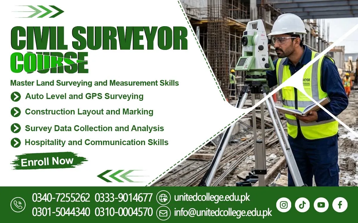

Civil Surveyor Course in Hangu Strengthen Construction Expertise
Master the Measurements That Guide Construction Projects
A construction project can face serious problems when land measurements and site layouts are not accurate. A building may be planned in the wrong position, a road may follow an unsuitable route, or ground levels may create difficulties during development. Civil surveying helps reduce these risks by providing reliable information about land, distances, elevations, and boundaries before construction begins.
The Civil Surveyor Course in Hangu introduces learners to the technical knowledge behind this important work. Civil surveyors help construction teams understand the actual conditions of a site and compare them with project plans. Their measurements support the planning of buildings, roads, residential areas, and infrastructure projects. For beginners interested in construction and land development, learning surveying can provide a practical introduction to the technical side of the industry.
The Surveyor’s Role in Turning Land Conditions into Construction Plans
Civil surveyors collect information that helps engineers and construction teams make informed decisions. They measure distances, check ground levels, identify important points, and study the boundaries of a site. Their work provides a clearer picture of the land before builders begin preparing the area or placing structures.
For example, when a building is planned on uneven ground, survey information helps the team understand differences in elevation. When a road is being designed, measurements help identify the route and changes in ground level. The Civil Surveyor Course in Hangu helps beginners understand these responsibilities and learn why accurate field information is an important part of construction planning.
Develop the Technical Skills Behind Accurate Land Measurement
Civil surveying combines basic mathematics with practical measurement methods. Learners explore how to measure distances, understand angles, compare elevations, and calculate land areas. They also become familiar with maps, technical drawings, and site plans. These skills help them understand how information collected in the field connects with the layout of a construction project.
Another important area is understanding land features through contour maps. Contour lines represent points with equal elevation and help readers recognize slopes and changes in ground height. Learners can also study basic site marking and construction layouts to understand how planned positions are transferred onto the ground. These topics form part of Civil Surveying Training and introduce beginners to useful Construction Surveying Skills.
Surveying Instruments That Turn Field Readings into Useful Information
Surveying instruments help professionals collect measurements and check site conditions. A measuring tape is commonly used to measure shorter distances, while a levelling instrument helps compare the heights of different points. These tools introduce beginners to basic field measurement and show why correct positioning and careful readings matter. More advanced equipment supports other surveying tasks.
A theodolite measures horizontal and vertical angles, while a total station combines angle and distance measurement functions. GPS-based tools help identify geographical positions using satellite signals. Understanding the purpose of these Surveying Instruments gives learners a foundation for exploring modern Practical Surveying Techniques. It also helps them recognize that each instrument has a particular purpose and must be handled carefully.
Connect Site Measurements with Building Layouts and Development Work
Surveying information becomes valuable when it helps a construction team understand where and how planned work should take place. A site layout shows the intended positions of buildings, access areas, and other project features. Surveyors use measurements and reference points to help transfer planned positions from drawings onto the actual ground.
This process is important in building construction, road planning, and land development. For instance, before a foundation is prepared, the team needs reliable information about its planned position and dimensions. Surveying also helps identify ground features that may affect construction decisions. A Civil Surveyor Course introduces learners to the relationship between measurements, site plans, and practical development activities.
Explore the Value of Surveying Knowledge in Hangu’s Development Activities
Construction and development work require a clear understanding of the land. In and around Hangu, people interested in technical construction subjects can explore how surveying supports building projects, road layouts, residential planning, and infrastructure activities. The same basic measurement principles apply across different types of sites, although each project may have its own technical requirements.
Learning the Civil Surveyor Course in Hangu can help local beginners understand how surveyors collect and organize site information. They can explore how measurements help identify boundaries, compare ground levels, and support planning decisions. This knowledge also introduces learners to the connection between civil engineering concepts and practical work carried out on construction sites.
Strengthen Observation, Accuracy, and Teamwork Through Surveying Practice
Good surveying requires more than knowing how to use instruments. A surveyor must pay attention to small details, check readings carefully, and record information in a clear format. Observation helps identify differences in the ground, while basic problem-solving helps learners understand what to do when measurements do not match expected results. Students enrolled in a Civil Surveyor Training in Hangu can develop these important skills through learning and practical activities.
Teamwork is also important because surveying information is often used by engineers, site supervisors, and construction workers. Clear communication helps everyone understand the measurements and their purpose. Through Surveyor Training, beginners can develop patience, technical understanding, and a responsible approach to fieldwork. These qualities support careful measurement and help learners become more confident when studying surveying procedures.
Learn the Foundations of Civil Surveying Through United College of Technology
The Civil Surveyor Course is offered by United College of Technology for individuals interested in learning about land measurement and construction-related technical work. The subject introduces learners to important surveying concepts and helps them understand how measurements, site layouts, and field records contribute to project planning.
For beginners, suitable training can make technical topics easier to understand by introducing them step by step. The Course in Hangu provides an opportunity to explore the basic knowledge associated with surveying, including measurement methods, levelling, maps, and instrument functions. Interested learners should review the available course information to understand the programme details and decide whether it matches their learning goals.
Apply Surveying Knowledge Across Construction Sites and Engineering Projects
Civil surveying knowledge has applications in several work environments. Construction sites use measurements to check land conditions and establish planned positions. Road projects rely on survey information to understand routes, ground levels, and site features. Land development and infrastructure activities also use measurements to support planning and technical decisions. Surveying-related assignments may involve collecting field data, preparing records, checking layouts, or assisting with site measurement tasks.
Accurate surveying also depends on safe and responsible fieldwork. Surveyors may work near vehicles, machinery, uneven surfaces, and active construction areas, so they must remain alert and follow site safety instructions. By exploring measurement methods, instrument use, and field procedures, learners can build a useful foundation for understanding the technical demands of construction. The Civil Surveyor Course in Hangu offers an opportunity to take that first learning step and discover how careful measurements help turn construction plans into organized development work.
Frequently Asked Questions (FAQs)
A plane table survey is a method in which a surveyor observes details and draws them directly on a sheet fixed to a board in the field.
A traverse station is a point where a surveyor takes measurements to establish a series of connected survey lines across an area.
A benchmark provides a fixed elevation reference that surveyors use when comparing the heights of other points.
A reduced level is the height of a point compared with an established reference level, often used to understand ground elevations.
Ranging rods help mark points and make survey lines easier to identify during field measurement activities.
A check line helps verify the accuracy of a survey framework by comparing an additional measurement with the recorded layout.
Admission Open: Start Your Professional Journey Today!
Join United College of Technology and build a career with practical training, recognized certifications, and Gulf job support. Seats are limited.
Apply Now via WhatsAppContact Information
- Address: Rawalpindi: F-272 Main New Katarian Stop, Old IJP Road | Lahore Campus: Lahore, Pakistan
- Phone/WhatsApp: 0340-7255262 / 0333-9014677 / 0301-5044340 / 0310-0004570 / 051-8770756
- Website: unitedcollege.edu.pk
















Leave a Comment