


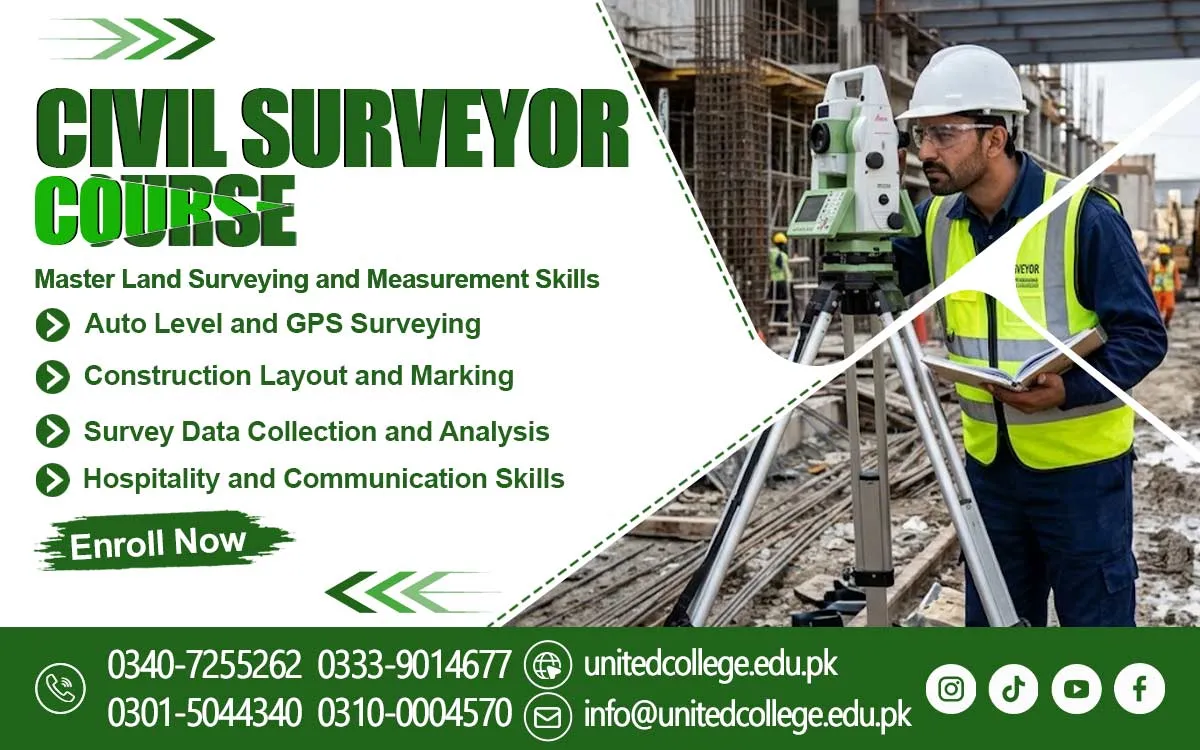

Civil Surveyor Course in Shangla – Develop Skills in Land and Site Surveying
Accurate Land Measurements for Reliable Construction Projects
A construction project can face serious problems before the first brick is placed if land measurements are incorrect. Imagine a team preparing to build a house, but the foundation markings are not properly aligned with the site plan. Even a small measurement mistake can affect the building layout, waste construction materials, and create expensive corrections. The Civil Surveyor Course in Shangla provides an opportunity for students and beginners to understand the practical work involved in land measurement, construction layouts, and site surveying. Civil surveyors help construction teams identify ground levels, measure distances, check elevations, and establish accurate reference points before and during development projects.
Their work is important for residential buildings, commercial structures, roads, bridges, and other infrastructure. Students interested in construction and technical work can develop useful knowledge through civil surveying training in Shangla. The field combines mathematical understanding, technical equipment, observation, and practical site experience. At United College of Technology (UCT), learners can explore the skills involved in professional surveying and understand how accurate measurements support construction activities. This training can help beginners build a foundation for further learning in the civil engineering and construction sectors.
The Essential Responsibilities of a Civil Surveyor on Construction Sites
A civil surveyor performs several important tasks that help construction projects follow their planned measurements and designs. Students enrolled in the Civil Surveyor Course learn how to carry out these responsibilities professionally. Before construction begins, surveyors visit the site, examine the available land, measure distances, and identify important reference points. These measurements help engineers and construction teams understand the actual ground conditions. For example, when a contractor plans to construct a residential building, the surveyor helps mark the building corners, foundation positions, and required distances according to the approved drawings.
Students enrolled in a Land Surveying Course can learn about these responsibilities and understand the connection between surveying and civil engineering. A professional surveyor must pay attention to small details because inaccurate measurements can affect the quality and position of a structure. Communication is another useful skill because surveyors regularly coordinate with engineers, supervisors, contractors, and other site workers. Civil Surveyor Training introduces learners to these responsibilities and helps them understand the importance of accurate records, organised working methods, and careful measurement practices in real construction environments.
Land Measurement Techniques and Accurate Boundary Identification
Land measurement is an important part of civil surveying because construction activities depend on knowing the correct dimensions and boundaries of a site. Before purchasing, dividing, developing, or constructing on a piece of land, its measurements may need to be checked carefully. A civil surveyor uses suitable instruments and measurement methods to determine distances, angles, positions, and ground features. For example, if a property owner wants to construct a house on a limited plot, accurate measurements can help identify the available space and establish the planned building area. Surveyors may also work on larger areas where roads, drainage systems, or other infrastructure are planned.
During Civil Surveying Training in Shangla, beginners can develop an understanding of land measurement techniques and the importance of recording measurements correctly. They can also learn about reference points, field notes, measuring distances, and interpreting basic site information. Boundary identification requires particular care because incorrect assumptions about property lines can lead to disagreements or construction complications. Surveyors must follow the relevant site records, instructions, and applicable procedures rather than estimating boundaries by appearance. Learning these practices gives students a useful foundation for working with land information and supporting construction projects where reliable measurements are essential.
Surveying Instruments Used for Professional Field Measurements
Modern civil surveying involves different instruments that help surveyors collect accurate information from construction sites and land areas. Beginners should become familiar with these tools because each instrument performs a particular function. A measuring tape is commonly used for checking short distances, while an auto level helps determine differences in ground elevation. A theodolite is designed to measure horizontal and vertical angles, which can support alignment and positioning tasks. A total station combines electronic distance measurement with angle measurement and can help surveyors collect site data efficiently.
These instruments require proper handling, setup, adjustment, and careful reading. For example, when checking the level of a proposed building foundation, a surveyor may use an auto level with a staff to compare ground heights at different points. Similarly, a total station can help establish positions for road construction or building layouts. Students exploring Total Station Training, Auto Level Surveying, and Theodolite Surveying can gain an understanding of the equipment used in modern construction surveying. At United College of Technology, learners interested in the Civil Surveyor Course in Shangla can develop awareness of surveying instruments and their applications.
Levelling, Alignment, and Elevation Control in Construction Work
A construction site may look flat from a distance, but the ground can contain small differences in height that affect building foundations, drainage, road surfaces, and other structures. Students enrolled in the Civil Surveyor Course learn how to measure these differences through levelling techniques. Levelling helps determine the height of one point compared with another and provides useful information for construction planning. For example, a road passing through an uneven area requires careful elevation checks to maintain suitable gradients and support proper water drainage. If ground levels are not considered during planning, rainwater may collect in unwanted areas or flow towards buildings. Alignment is equally important because structures must follow their intended positions and directions.
Surveyors establish reference lines and points that guide construction teams during excavation, foundation work, and structural development. Through practical learning, students can understand the relationship between levelling and alignment and become familiar with common field procedures. Civil engineering skills also involve recording readings, checking calculations, and identifying possible measurement mistakes. A good understanding of elevation measurements can help beginners recognise the importance of accurate site information. These techniques are used in residential construction, road surveying, drainage projects, and other infrastructure developments where correct positioning and ground levels directly influence construction quality.
Building Layout and Site Surveying Techniques for Structural Accuracy
Before workers begin excavation or foundation construction, the planned structure must be transferred from engineering drawings onto the actual ground. This process is commonly known as building layout or setting out. A surveyor uses measurements, reference points, and suitable instruments to mark the positions of walls, columns, foundations, and other important building elements. For example, a house plan may show several rooms, boundary distances, and foundation dimensions. The surveyor helps establish these positions on the site so that construction workers can follow the planned design. Site surveying techniques also support larger projects, including commercial buildings, warehouses, bridges, and road networks.
Surveyors must compare site conditions with the available drawings and report any differences that require attention. Map reading and interpretation are useful skills because construction professionals need to understand symbols, dimensions, scale, and reference information shown in technical drawings. Students taking a Surveyor Course in Shangla can learn why proper site preparation and accurate building layout are important for structural work. They can also understand the value of checking measurements before marking positions. Careful planning at this stage helps reduce avoidable errors and supports better coordination between surveyors, engineers, contractors, and construction workers.
Practical Surveying Training and Fieldwork Experience for Beginners
Reading about surveying instruments is useful, but understanding their actual operation requires practical experience. A beginner may know that an auto level measures elevation differences, yet using it correctly involves setting up the tripod, adjusting the instrument, positioning the staff, and taking readings carefully. Similarly, working with a total station requires familiarity with instrument setup, target positioning, measurement procedures, and basic data collection. Practical surveying training helps learners connect classroom knowledge with the activities performed on construction sites. During training, students can develop confidence in handling equipment, measuring distances, recording field observations, and following basic surveying procedures.
They can also practise working with measurement calculations and understand the importance of checking results instead of relying on a single reading. United College of Technology (UCT) offers learning opportunities for individuals interested in developing technical knowledge through civil surveyor training. Students should focus on understanding each procedure rather than simply memorising instrument names. Practical exercises involving site measurements, levelling, and basic layout work can make technical concepts easier to understand. This approach is especially useful for fresh learners who have little or no previous experience in construction. Consistent practice, attention to detail, and guidance from instructors can help students build a stronger foundation in surveying.
Road Surveying and Infrastructure Development Across Different Projects
Civil surveyors contribute to many infrastructure projects where accurate ground information is necessary for proper planning and construction. Students studying the Civil Surveyor Course learn about these important surveying activities. Roads are a common example because their routes, widths, elevations, and gradients must be measured carefully. Before a road is constructed, surveying teams collect information about the existing land and identify important ground features. This information helps engineers prepare suitable designs and understand the conditions along the proposed route. In hilly areas, changes in ground elevation can make road planning more challenging. Surveyors may need to measure slopes, identify changes in terrain, and collect topographic information to support engineering decisions.
Topographic surveying focuses on recording natural and man-made features of an area, such as hills, roads, buildings, drainage channels, and ground levels. Similar work is important for bridges, water supply systems, residential developments, and commercial construction projects. In Shangla and surrounding areas, knowledge of surveying can be useful for understanding the measurement challenges associated with different types of terrain and construction sites. Students can explore Road Surveying, Topographic Surveying, and construction surveying as important parts of the civil surveying field. Learning these applications helps beginners understand that surveyors do more than measure land; they also provide essential information that supports infrastructure planning and development.
Career Preparation Through Professional Civil Surveying Skills
A strong understanding of civil surveying can provide beginners with a useful technical foundation for exploring different areas of the construction industry. Surveying-related work may involve assisting experienced surveyors, supporting site engineers, recording measurements, preparing field notes, and helping with construction layout activities. However, job responsibilities depend on practical ability, qualifications, experience, and the requirements of individual employers. Students should understand that completing a training course is a starting point rather than a guarantee of employment. Developing professional surveying skills requires regular practice, equipment familiarity, mathematical accuracy, and the ability to follow technical instructions.
Communication and teamwork are also important because surveyors coordinate with different construction professionals throughout a project. Learners should become comfortable with reading drawings, maintaining measurement records, identifying possible errors, and reporting site observations clearly. The Civil Surveyor Course in Shangla offered by United College of Technology can help interested students explore these technical areas and develop knowledge relevant to construction surveying. Beginners can also continue improving their abilities by gaining supervised field experience and learning more advanced surveying methods. A responsible approach to training helps students understand the actual demands of the profession and prepare for future learning opportunities in civil engineering and infrastructure development.
Technical Learning Opportunities at United College of Technology for Shangla Students
Choosing suitable technical training is an important step for anyone interested in entering the surveying field. Students should look for learning opportunities that explain surveying concepts clearly and help them understand the practical use of equipment. The Civil Surveyor Course in Shangla, offered by United College of Technology (UCT), is relevant to individuals who want to explore land measurement, construction site activities, surveying instruments, and basic field procedures. The learning journey can introduce beginners to subjects such as levelling, alignment, building layout, map reading, and measurement accuracy. These areas are connected to everyday construction activities and help learners understand the responsibilities of a civil surveyor.
Students interested in this field should also develop good observation habits, basic mathematical skills, and a willingness to practise technical procedures. Before enrolling, learners can contact UCT to confirm the current course duration, admission requirements, available practical facilities, and training arrangements. This allows them to make an informed decision according to their learning needs. Civil surveying requires patience and accuracy, but it can be an interesting technical field for people who enjoy outdoor work, measurements, construction planning, and using specialised instruments. With suitable training and continued practice, beginners can build knowledge that supports their future development in the civil surveying and construction sectors.
Frequently Asked Questions (FAQs)
The Civil Surveyor Course in Shangla teaches students land measurement, levelling, construction surveying, site layouts, and the use of surveying instruments.
Students, beginners, fresh learners, and individuals interested in construction and civil engineering can consider joining this course.
Students can learn land measurement techniques, levelling, alignment, map reading, building layout, and basic surveying equipment operation.
Common surveying instruments include total stations, auto levels, theodolites, measuring tapes, and surveying staffs.
Practical learning helps students understand equipment handling, site measurements, levelling procedures, and construction layout techniques. Contact UCT to confirm the available practical training arrangements.
Admission Open: Start Your Professional Journey Today!
Join United College of Technology and build a career with practical training, recognized certifications, and Gulf job support. Seats are limited.
Apply Now via WhatsAppContact Information
- Address: Rawalpindi: F-272 Main New Katarian Stop, Old IJP Road | Lahore Campus: Lahore, Pakistan
- Phone/WhatsApp: 0340-7255262 / 0333-9014677 / 0301-5044340 / 0310-0004570 / 051-8770756
- Website: unitedcollege.edu.pk
















Leave a Comment